Earth Science Lab #8 - Topographic
Profile Exercise
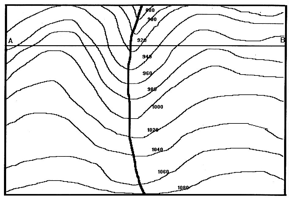 1. The above topographic map shows a river flowing through
a valley. In which geographic direction does the stream flow?
How do you know the stream's direction? What is the contour interval?
1. The above topographic map shows a river flowing through
a valley. In which geographic direction does the stream flow?
How do you know the stream's direction? What is the contour interval?
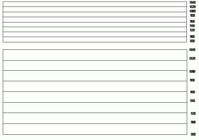 2. Construct a topographic profile (cross-sectional view
of the land surface) defined by the East-West profile line "A-B."
Lay a sheet of blank paper below line A-B. Mark off the positions
of the end points A and B, then mark off the positions and elevations of
the contours and the stream which intersect the profile line. Move
the sheet of paper to the vertical elevation box below, line up Points
A and B with the margins of this box, and transfer the positions of the
elevation contours to the appropriate elevation line. Draw a smooth
profile line connecting the points. Your profile must be drawn all
the way across without any gaps. (You will need to interpolate the
elevation of the stream, point A and point B, by reading their relative
positions to the nearest known contours.) Draw another profile in
the second box below, which has a vertical exaggeration double that of
the first box. Your profile should show a typical V-shaped stream
valley.
2. Construct a topographic profile (cross-sectional view
of the land surface) defined by the East-West profile line "A-B."
Lay a sheet of blank paper below line A-B. Mark off the positions
of the end points A and B, then mark off the positions and elevations of
the contours and the stream which intersect the profile line. Move
the sheet of paper to the vertical elevation box below, line up Points
A and B with the margins of this box, and transfer the positions of the
elevation contours to the appropriate elevation line. Draw a smooth
profile line connecting the points. Your profile must be drawn all
the way across without any gaps. (You will need to interpolate the
elevation of the stream, point A and point B, by reading their relative
positions to the nearest known contours.) Draw another profile in
the second box below, which has a vertical exaggeration double that of
the first box. Your profile should show a typical V-shaped stream
valley.
Copyright © 1994 by William K. Tong